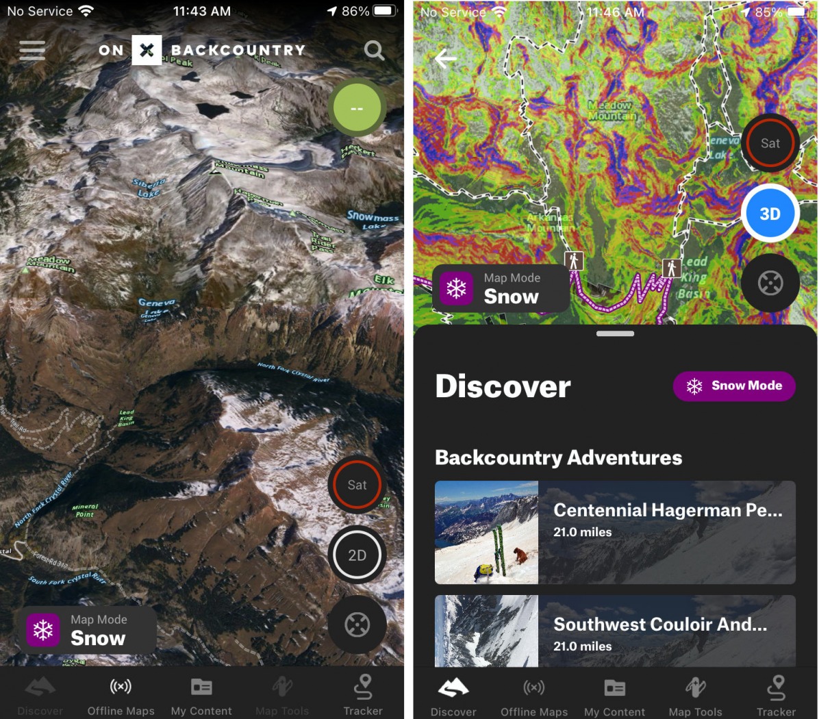
onX Backcountry offers a simple and user-friendly interface and unique features like 3D satellite imagery to aid with planning and integration with crowd-sourced backcountry route resources like Powder Project.
GPS devices have come a long way since the first consumer handheld GPS device was developed in 1988. The Magellan Nav 1000 GPS Receiver weighed 1.5 pounds and cost $2000. Fast forward to 2021 and GPS is as ubiquitous as 5G and available for free or a small fee in the palm of your hand. Mapping software has evolved with it; not only can we track our progress on existing routes, but we can also create new ones, view 3D topography, illuminate slope angles and tree cover, take photographs to accompany way points, and share with all of our social networks afterwards, all via the smartphone. It’s actually incredible.
I was a slowcomer to online GPS mapping and apps, preferring the tactility of lines on paper to squinting at a little blue dot on a little rectangular screen. Mostly thanks to mountain biking, I eventually decided to get with the times. GPS apps like MTB Project and Trail Forks make it easy to explore new zones and plan link-ups. Unfamiliar places become quickly familiar when they’re mapped in extensive detail and getting un-lost is a lot easier when you have a little blue dot telling you exactly where you are.
Of course, the ski touring applications are even wider with slope angle shading (despite its limitations), objects to designate ‘no’ and ‘go’ territory, and the ability to visualize with impressive detail what’s around you. This spring, I’ve been playing around with the new onX Backcountry software for all of that. The app, which joins Gaia maps and CalTopo in having applications specifically geared to ski touring, advertises its ease of use, offline capabilities and integration with ski touring information like avalanche forecasts and route guides. Here are my impressions of it thus far.
App Overview
Montana based onX Maps was on the forefront of digital mapping software when founder Eric Siegrid developed onX Chip in 2009. It later became onX Hunt, one of the first digital mapping software for hunters. The app distinguished itself by offering a filter for public and private land boundaries, super important for hunting (make sure that elk you’re aiming for isn’t on someone else’s land). The company has since branched out to onX Off Road and most recently onX Backcountry.
Notable features
The Backcountry version of the onX app has two primary settings: hike and snow. The hike setting offers detailed trail maps, along with crowd-sourced and rated trail guides. The snow setting shares features now standard with other GPS mapping apps including the ability to design a track, insert objects, mark way points with photos, use landscape filters like slope angle shading and track your route real time. But it has a couple of things that set it apart from others also.
Simple and intuitive
I’m not a GPS map geek and don’t plan on becoming one. My criteria for effective mapping software is pretty basic: I want to be able to map out routes, keep track of where I am when I’m out of service and have enough safety aspects like slope angle shading to know where I want to avoid going. I find CalTopo with its seemingly limitless filters overwhelming and end up using the same ones while wondering if I’m missing out on something with the others.
onX Backcountry starts with a USGS Topo map (you can choose the scale) and offers only a few select filters: slope angle shading and avalanche forecast, topo view, satellite or hybrid. You can also enable 3-dimensional view. It’s easy to toggle between the feature icons right in the app, whether you’re online or off.
No need to use a desktop
You can use the app on a desktop or tablet to map out your route, save to your account and download to the app on your phone, but you don’t have to. onX Backcountry streamlines the process of moving from creating a map to downloading and using it offline by allowing you to do all of it on your phone. Personally this helps route making feel a little less like a chore, despite that it’s on a smaller screen.
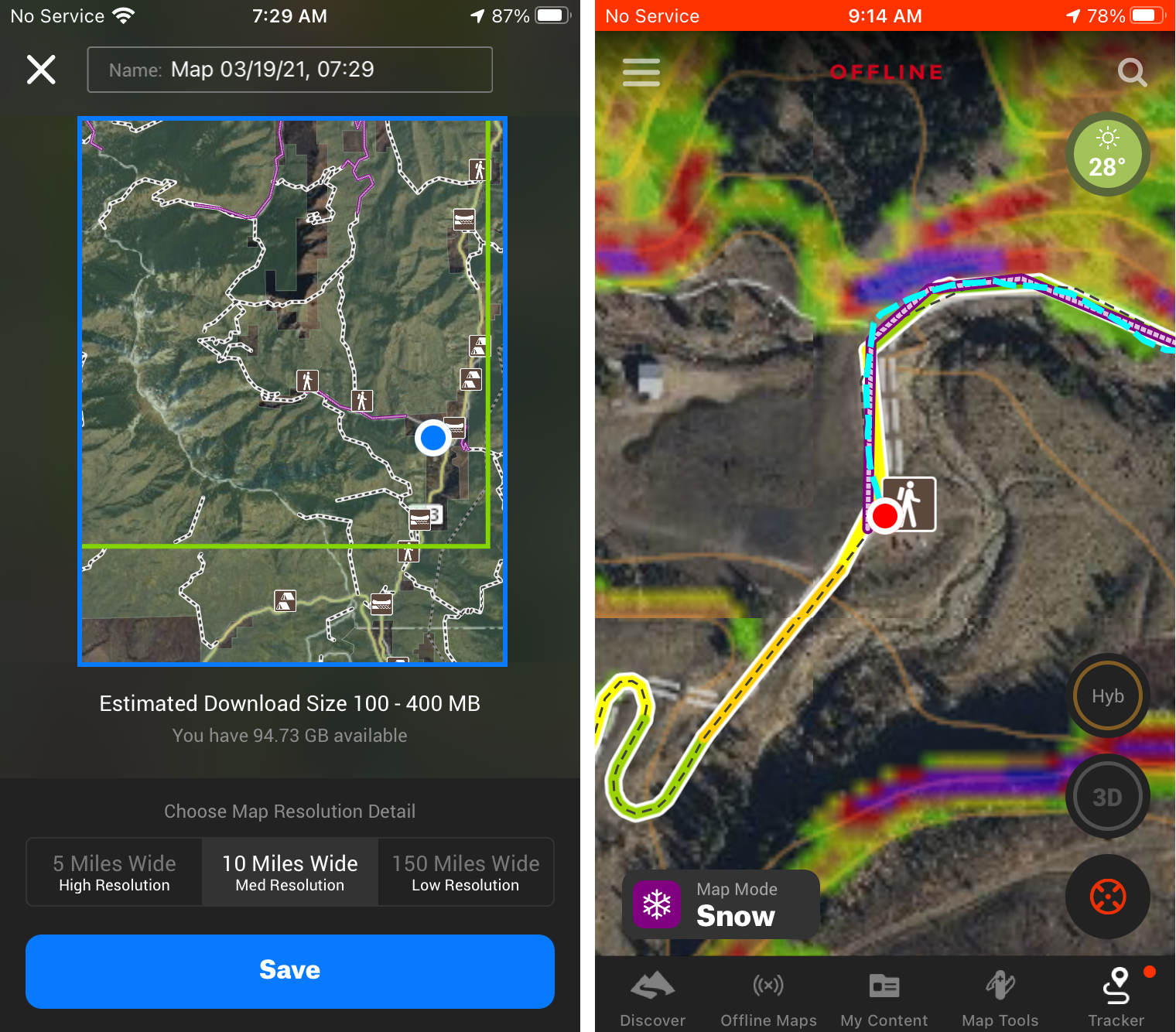
You can plan and save maps directly on the phone app. In the field, you can track your progress and mark way points with notes and photos along the way.
Integrated with Powder Project, avalanche forecast zones and more
In late 2020, onX acquired the crowd-sourced app collective, Adventure Project, home to the climbing forum and app Mountain Project, the ski touring app Powder Project, Hiking Project, Mountain Bike project and more. Now, the data from all of these individual crowd-sourced apps is integrated into onX maps. In the case of onX Backcountry, this means you can search for a zone and all recorded, nearby ski (or hiking in Hike mode) routes come up on your phone. So if you’re planning a trip and want to find a new zone to explore, you can find a route, download the gpx and be on your way.
(For those who are concerned about how this acquisition will impact the historically free Adventure Project sites and apps, this Rock and Ice article does a good job explaining things.)
As for other integrations, you can check the danger scale rating of your location by turning on the Avalanche Forecast overlay. (It doesn’t offer access to the detailed forecast yet; maybe in the future). In the near future, Beacon Guidebook routes will be integrated into the map data. Oh, and Cody Townsend is keeping track of his 50 Classics routes on the app, for those who want to follow along and re-create.
Taking it in the field
So far this season, I’ve mostly used the app when exploring a new zone near WS HQ. I’ve created and saved a few different maps, taken them offline and played with different filters. I find the app easy and intuitive to use, as accurate as any other mapping software and it doesn’t burn through my phone battery in any significant way, especially when I keep the phone on airplane mode.
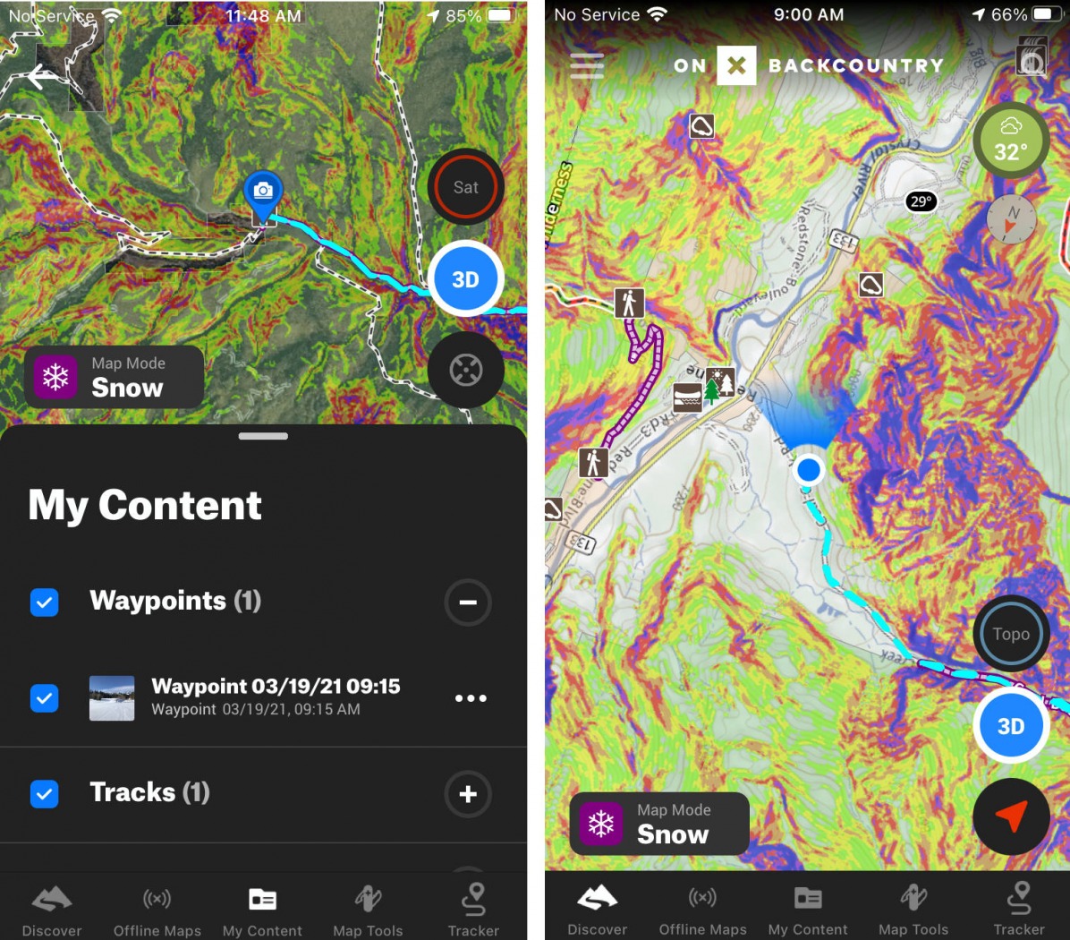
Similar to some other mapping software, you can customize your waypoints with notes and photos. You can also toggle between different direction indicators depending on how you want to orient your compass.
A few specific features I’ve appreciated are the ability to toggle between filters when using it offline. If I want to turn slope angle shading off, but keep the avalanche forecast on, I can do that or vice versa. I can also change the orientation of the screen so north is always at the top, choose whether the blue dot illuminates the direction I’m facing and I can check the weather to see what the wind and barometer are up to, all offline.
I’ve also used the tracking option, and found it to match the GPS tracking on my Suunto watch by running them both simultaneously. Way points are easy to mark with notes or a photo. The blue dot doesn’t show noticeable delays in catching up to me when I haven’t checked the app for a while.
Comparisons
onX Backcountry most closely compares to features available in Gaia, with the notable differences being the integrations with crowd-sourced maps and guides. There are a couple of price differences too, the full breakdown of which you can view by visiting each site.
Gaia: basic membership $20, premium membership $40
onX Backcountry: Premium $30/yr
CalTopo: $20/yr basic membership, $50/pro with more features
Closing thoughts
With Hunt, onX became a go-to digital mapping resource in the app world and there’s a lot of buzz around what can happen with onX Backcountry as they continue to evolve the software. Digital mapping aficionados may want more filters but for ski tourers looking for an easy to use, accurate, effective mapping software to create routes, find routes and take out of service, onX is a solid option.
For a limited time, WildSnow readers can receive 20% discount on a premium membership. Use the promo code WILDSNOW20 when checking out on the onX website, or the digital app.
Manasseh Franklin is a writer, editor and big fan of walking uphill. She has an MFA in creative nonfiction and environment and natural resources from the University of Wyoming and especially enjoys writing about glaciers. Find her other work in Alpinist, Adventure Journal, Rock and Ice, Aspen Sojourner, AFAR, Trail Runner and Western Confluence.