
Backcountry Skiing
Key in Colorado at the moment is to start any backcountry skiing from as high an altitude as possible. Around here we’re limited by a bunch of closed roads, but it’s actually a fairly short drive to Vail Pass on Interstate 70, so we headed over there this past Sunday to see what Uneva Peak was like. Near total whiteout and a chilly breeze kept us from the summit, but a few laps in the trees harvested spring powder on top of a firm base.
I’d anticipate this new layer of snow providing excellent skiing over the next several days, until it melts down to the dirt layer again. Cloudy weather today, so that might delay the surface melting and give us good conditions this weekend. Till then, a few photos that capture some of the stormlight.

Lisa headed up, with her CAMP Campack X4 800, an amazingly nice rucksack that combines lots of volume with feather weight. Reviews soon.

It's always fascinating how you can be in a whiteout above timberline, then get down in the trees where light is bouncing around and thus see quite well. Such light makes for nice photos along with tasty turns. Uneva Peak is on the north side of I70 at Vail Pass. You can access a bunch of alpine terrain up there, but also ski some old logging areas and burns that provide a huge amount of underutilized backcountry skiing. With the present controversy surrounding our pine beetle infestations and overdone fire suppression, along with logging-as-sin views, I'm always amused when we have a good day in an area that's been provided by loggers or flame. Indeed, being out there on the land sure puts things in perspective.
[gmap name=’mymap’ lat=’39.55695′ lng=’-106.19614′ zoom=’13’ maptype=’g_hybrid_map’ desc=’Uneva Peak.’ width=’525′]
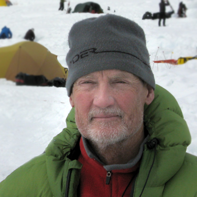
WildSnow.com publisher emeritus and founder Louis Dawson has a 50+ years career in climbing, backcountry skiing and ski mountaineering. He was the first person in history to ski down all 54 Colorado 14,000-foot peaks, has authored numerous books about about backcountry skiing, and has skied from the summit of Denali in Alaska, North America’s highest mountain. He published his memoir, Avalanche Dreams: A Memoir of Skiing, Climbing, and Life in 2024.